|
Spatio-temporal data is often displayed using regional aggregation or heatmaps, which are useful for exploring large distributed trends or working to unearth the cause of more localized behavior. For individual users that live and work in the region, however, these representations are inaccessible and difficult to put into practice. We present a new technique for exploring spatio-temporal data as personal routes through a geographic area. |
Pedestrians are the largest group of road-users and they represent a large proportion of road casualties. The researchers have found some evidence that divided attention disrupts walking; making people less likely to notice novel stimuli and more likely to cross a street in a risky fashion. More than 1,500 pedestrians were estimated to be treated in emergency rooms in 2010 for injuries related to using a cell phone while walking, according to a new nationwide study. |
Due to the physical and spatial disconnect, online learners frequently experience social isolation that negatively impacts students' well-being and learning experiences. We present an AI agent named SAMI (stands for Social Agent Mediated Interaction) that can read and analyze online learners' self-introduction posts on the class discussion forum to connect students with similar interests together. In the poster, we describe how SAMI works and what the online learners think of SAMI. We then discuss the potential of human-AI interaction research under the theoretical framework of Mutual Theory o |
Recently featured in Georgia County Government magazine, the SayWhyPoll mobile app enables elected officials, civic leaders, and media producers to engage with constituents and audiences either remotely or face-to-face using surveys that tightly couple close-ended survey items with rich media, such as video. The SayWhyPoll is designed to increase opportunities for public debate on civic issues, but is also suitable for pure entertainment topics, such as sports and lifestyle.  |
|
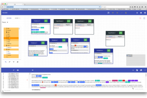
SCADE is a visual text analytic tool. The goal of the project is to help analysts make sense of a larger number of text document while tracking the analyst's provenance.  |
Story generation is the problem of automatically selecting a sequence of events that meet a set of criteria and can be told as a story. Story generation is knowledge-intensive; traditional story generators rely on a priori defined domain models about fictional worlds, including characters, places, and actions that can be performed. Manually authoring the domain models is costly and thus not scalable. We present a novel class of story generation system--called an Open Story Generator--that can generate stories about any topic.  |
We are working with Atlanta Public Schools (APS) to design a school bus information system that streamlines communication between parents, school administrators, and APS. Parents are empowered with pertinent information like late buses and substitute drivers, so they can know when the bus is coming and when it has safely arrived at school. With relevant bus tracking information and the ability to send announcements, the tool helps schools manage their morning arrival and afternoon dismissal processes. |
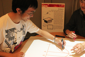
Sketching plays an important role in learning in the sciences. The process of sketching can help students think about and better understand scientific concepts. By sketching collaboratively, students can also compare their mental models with each other and share them with instructors in order to further enhance their understanding.  |
|
Using scrapy a python framework to scrape Sino Weibo without the API. |
We will demonstrate a Software-defined networking (SDN) controller that orchestrates traffic engineering for adaptive bit rate video streaming. An OpenFlow-enabled SDN architecture in combination with MPEG-DASH constitutes an optimized and seamless video streaming platform. The GENI infrastructure was utilized to evaluate video traffic over current network architecture and SDN architecture.  |
Georgia Tech scientists and engineers who are working together to install a network of internet-enabled sea level sensors across Chatham County. Website: |
When a person goes missing, the ability to quickly canvas a large area is crucial. However, many search and rescue missions occur in rough terrain where it can be difficult, slow, and even dangerous to cover on foot. Drones have become a cost- and time-effective solution, able to quickly fly over areas of interest and provide a video feed from a mounted camera. A pilot and spotter monitor the video feed through an app on a tablet or phone and watch for clues which might indicate where the missing person is located. |
|
Seed is a sensor and electronics educational database developed for use at the Interactive Product Design Lab. The lab teaches designers electronic prototyping skills-- Seed assists in this mission by providing information on electronic components through an online database, physical RFID card library, and RFID sensing unit. Parts are categorized into 6 groups: logic, power, input, output, tools, and projects. When a student needs information about a component, they can select a card and place it on the RFID reader. |
Self-directed online learning is becoming increasingly prevalent. We describe a study on the use of an online laboratory for self-directed learning through the construction and simulation of conceptual models of ecological systems. We analyzed the modeling behaviors of 315 learners and 822 instances of learner-generated models using a sequential pattern mining technique. We found three types of learner behaviors: observation, construction, and exploration. We found that while the observation behavior was most common, exploration led to models of higher quality. Website: |
In this project we intend to understand the gold standard of care in the domain for type 2 diabetes self management. Our design creates an experience for older adults of underserved communities to better improve point of care contact for type 2 diabetes in a useful and usable way. |


